The Wildflower Trail shows the variety of special green spaces across Adur and Worthing, from street verges to parks and private gardens, which support our pollinator friends. We have developed a series of circular walking trails to help you visit them – the maps can be downloaded below.
We would like to thank our funders, Rampion Community Benefit Fund via Sussex Community Foundation, for their support in creating these.


Happy walking and if you enjoy the trail please send us photos of your walks to our Instagram @thewildflowertrail and follow us there too.
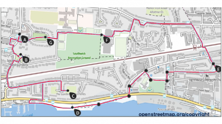
BN41 & 42 Southwick & Fishersgate
Enjoy this circular walking route, starting from Southwick Community Centre. The trail takes around an hour to complete and offers an easy, mostly flat stroll—perfect for a relaxed outing. As you make your way along the route, take a moment to appreciate the colourful wildflowers that help support our vital pollinators. Enjoy the
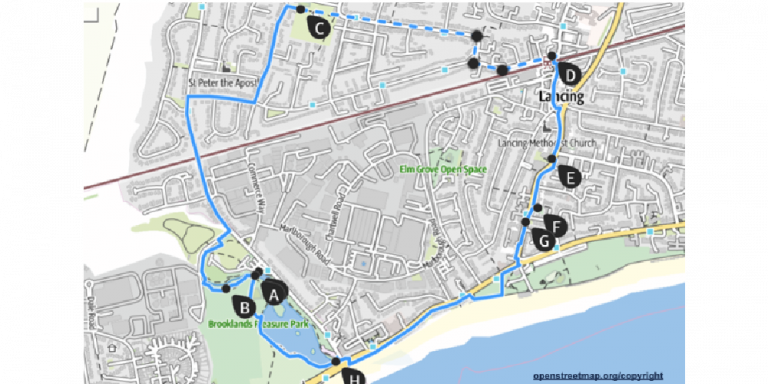
BN15 Lancing South
Enjoy this circular walking route, beginning at Brooklands Park. The trail takes around an hour to complete and offers an easy, relaxing stroll—ideal for a peaceful escape. As you wander, look out for the wildflowers that brighten the landscape, these blooms are vital for supporting our pollinators. Take your time, enjoy the fresh
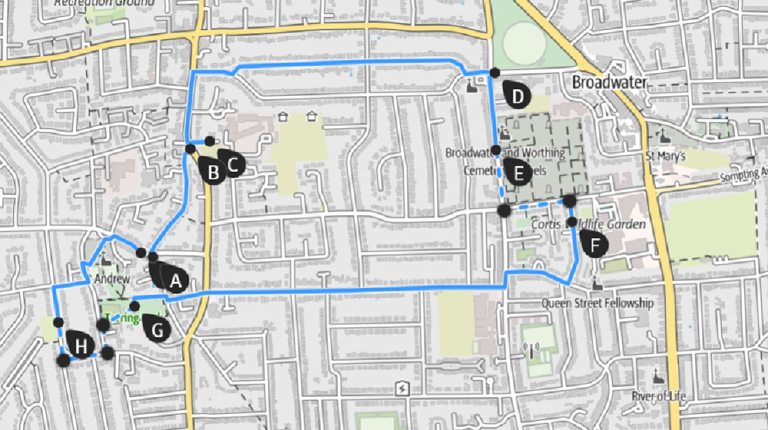
BN13 & 14 Tarring & Broadwater
Enjoy this inviting circular walking route—perfect for a gentle, flat stroll. You can start from Dukes Coffee Shop or Broadwater Green, and the full loop takes around an hour and a quarter at a relaxed pace. As you wander, look out for the wildflowers that bring colour and life to
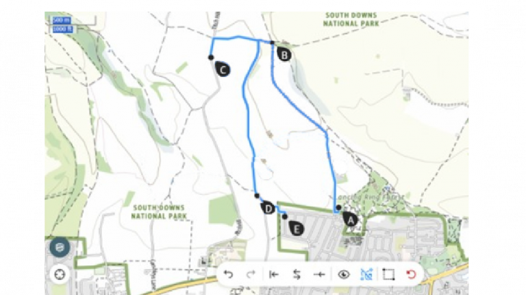
BN15 Sompting North
Enjoy this scenic circular walking route, perfect for those who love a rewarding climb with stunning views. You can begin your adventure from any of the suggested starting points such as Halewick Park Car Park, Titch Hill Car Park or Herbert Road. The full route is around 4 miles and takes roughly two

BN15 Sompting South
Enjoy this charming circular walking route, beginning at Hamble Recreation Ground. The trail takes around an hour and three quarters to complete and offers an easy, flat stroll—perfect for a relaxed outing. As you walk, take a moment to appreciate the colourful wildflowers along the way, these blooms provide vital support for our
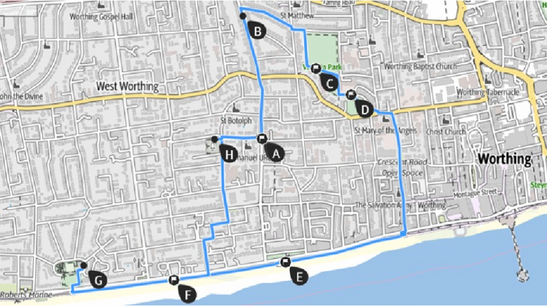
BN11 West Worthing
Enjoy a relaxing circular walking route that showcases the best of the local landscape. Start your stroll from either Heene Community Centre or Marine Gardens and follow the gentle, flat path—it takes around an hour and a quarter at an easy pace. As you wander, keep an eye out for